The Atacama Desert at a glance
Some weather stations in the Atacama have never recorded rain, NASA has tested Mars rovers here since 1997, and the coastal Chinchorro people were mummifying their dead about 2,000 years before Egypt. You come for steam rising off geysers at 4,300 m at dawn, for floating in a lagoon saltier than the sea, for flamingos on a salt flat larger than Luxembourg and for a Milky Way bright enough to see your way by.
|
|
| What it is |
The driest non-polar desert on Earth; a cool coastal desert between the Pacific and the Andes |
| Where |
Northern Chile: mostly the Antofagasta region, plus parts of the Atacama and Tarapacá regions; some definitions extend it into southern Peru |
| Length |
1,000–1,100 km north to south (Britannica); up to about 1,600 km under the broader WWF ecoregion definition |
| Area |
About 105,000 km² for the core desert; about 128,000 km² including the barren lower Andean slopes |
| Rainfall |
About 15 mm a year across the desert (CONAF); under 2 mm a year in the hyperarid core |
| Age of hyperaridity |
At least 40 million years, according to a 2026 Nature Communications study |
| Main base for travellers |
San Pedro de Atacama, about 2,400 m above sea level |
| Nearest airport |
Calama (CJC), about 1.5 hours by road from San Pedro |
| Best-known sights |
Valle de la Luna, El Tatio geysers, the Salar de Atacama and Laguna Chaxa, the Altiplanic lagoons, Laguna Cejar, Piedras Rojas, Puritama hot springs |
| Currency |
Chilean peso (CLP) |
| Entry |
Visa-free for up to 90 days for US, UK, EU, Canadian and Australian citizens; online SAG customs declaration required |
| Language |
Spanish; many tour guides in San Pedro also speak English |
| Best time |
Year-round; spring (September to November) and autumn (March to May) give the best balance. See the best time to visit. |
Other experiences you might enjoy
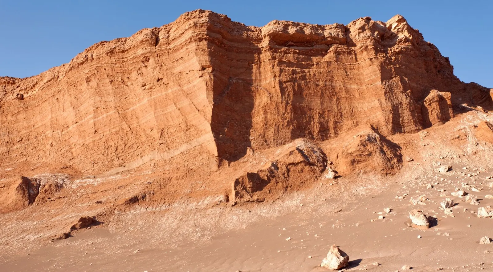
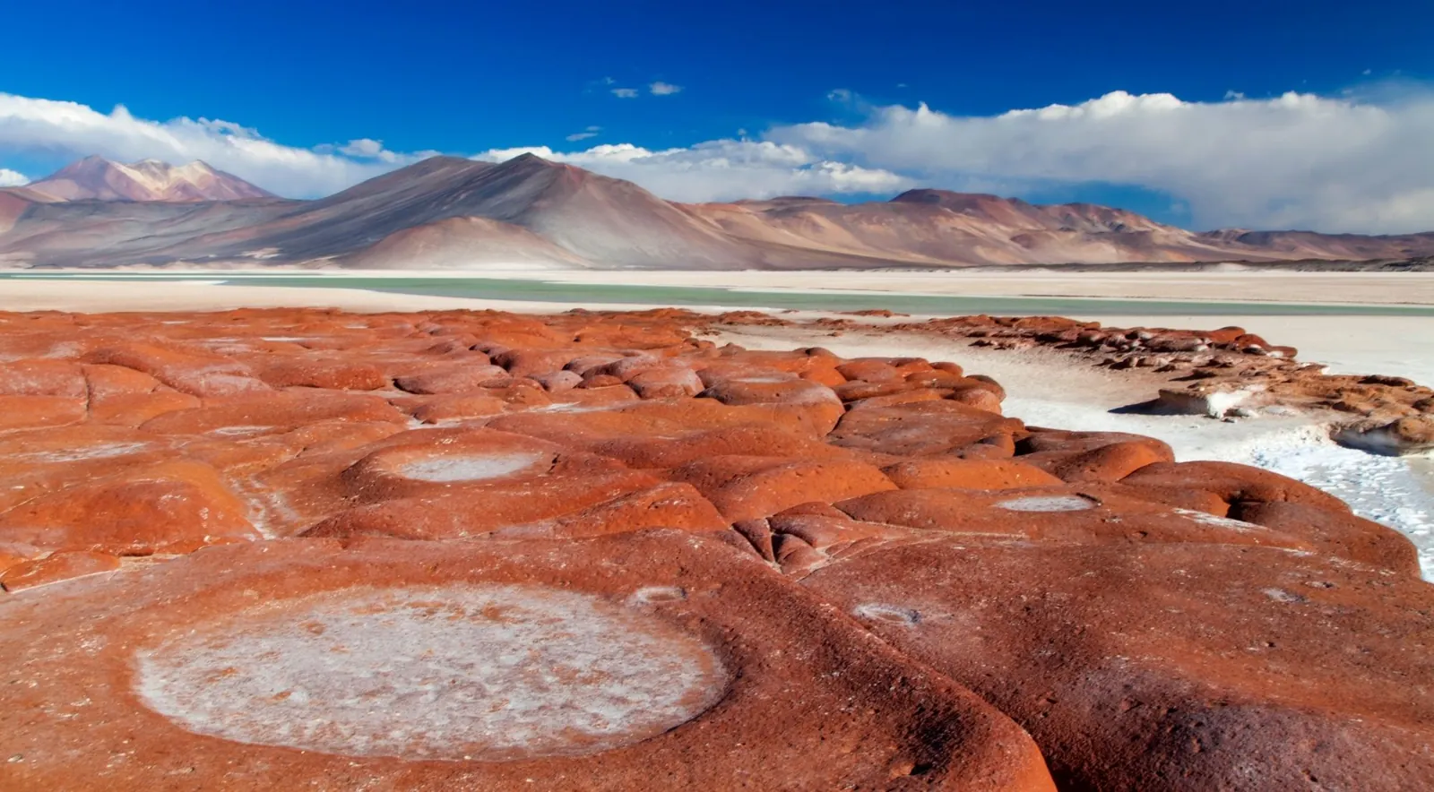
From San Pedro you can compare sunset at Valle de la Luna, sunrise at the El Tatio geysers, the Altiplanic lagoons and Piedras Rojas, the flamingos of Laguna Chaxa and an evening of stargazing under the desert sky.
What is the Atacama Desert?
It is a cool, extremely dry desert running along Chile’s Pacific side from the Peruvian border south towards Copiapó. Britannica describes it as a “cool, arid region in northern Chile, 600 to 700 miles (1,000 to 1,100 km) long.” It is called the driest non-polar desert on Earth because large parts of it get almost no rain at all.
Where exactly is it, and how big?
The Atacama sits between two mountain walls: the Chilean Coastal Range (Cordillera de la Costa) to the west and the Andes to the east. Britannica says it covers most of the Antofagasta region and the northern part of the Atacama region. To the north it continues to the Peruvian border, and along the Argentine and Bolivian borders the high Atacama Plateau (Puna de Atacama) rises to 4,000 m and more.
The size depends on who draws the map:
- About 105,000 km² is the most-cited figure for the desert proper, used in a 2018 Scientific Reports paper and in many reference works.
- About 128,000 km² if you include the barren lower slopes of the Andes.
- About 130,000 km² for the “inner desert”, according to UC Berkeley soil scientist Ronald Amundson, quoted by Live Science.
- Up to about 1,600 km long under the WWF ecoregion definition, which runs from near Arica (18°S) to near La Serena (30°S).
This page uses about 105,000 km², and broader definitions give larger figures. Peru’s southern coastal desert is sometimes counted as part of the Atacama (National Geographic does so), but Bolivia and Argentina only border the high Puna de Atacama and are not usually counted in the desert itself.
Why is the Atacama so dry?
Three forces stack on top of each other:
- The Andean rain shadow. The Andes block moist air moving west from the Amazon basin.
- The South Pacific High. A semi-permanent high-pressure system keeps the air sinking and stable, which suppresses cloud.
- The cold Humboldt Current. Cold upwelling water chills the air above the ocean and creates a temperature inversion. Moisture stays low as coastal fog, the camanchaca, instead of rising to form rain clouds, and the Coastal Range blocks much of that fog from moving inland.
The result is a double rain shadow: moisture is cut off from the east by the Andes and from the west by the cold ocean and the coastal mountains.
How dry is “driest”? The rainfall numbers
- Desert-wide average: CONAF says the Atacama normally receives about 15 mm of rain a year, with some places getting only 1–3 mm. Winter 2026 was a dramatic exception, with unusually heavy rain in parts of the north.
- Hyperarid core: under 2 mm a year, according to a 2019 Scientific Reports palaeoclimate study. Rainfall rises quickly with altitude, from under 20 mm a year at 2,300 m to over 300 mm at 5,000 m, which is why the high lagoons and volcanoes around San Pedro get snow.
- Driest measured site: María Elena South. Researchers led by Armando Azua-Bustos reported in 2015 that it is “much drier” than the long-famous Yungay area, with a mean air humidity of 17.3% and a constant soil humidity of 14% at 1 m depth, “a value that matches the lowest RH measurements taken by the Mars Science Laboratory at Gale Crater.”
- Long dry spells: periods of up to four years without rain have been recorded between Antofagasta, Calama and Copiapó. Britannica notes that some areas get heavy rain only two to four times a century.
How old is the Atacama?
The answer changed in 2026. For decades the standard line was that the core had been hyperarid for about 15 million years. A study by Ritter-Prinz and colleagues at the University of Cologne and the SUERC isotope centre in Glasgow, “Evidence for Eocene aridification of the Atacama Desert’s hyperarid core”, published in Nature Communications in 2026, dated cosmogenic nuclides in quartz pebbles. It concluded that hyperarid conditions began at least 40 million years ago, about 20 million years earlier than previously thought. That supports the common claim that the Atacama is the oldest continuously dry desert on Earth, although the Namib is sometimes put forward as a rival.
It rains, it snows, it blooms
- Snow in 2025: in late June 2025 a rare storm covered much of the high Altiplano in snow. ALMA reported its first measurable snow at the facility in nearly ten years and paused operations, and NASA’s Earth Observatory photographed it from orbit.
- Snow in 2026: in August 2026 back-to-back winter storms spread snow across much of northern Chile. ALMA suspended observations again in mid-August, and access to El Tatio and Machuca was restricted.
- The flowering desert (desierto florido), 2026: the same winter rains triggered an exceptional bloom in the southern Atacama, around Copiapó, Vallenar, Caldera and Freirina. Flowers began appearing in the second half of August, with the peak expected in October. This is far south of San Pedro, so treat it as a separate trip.
- What it means: climatologist Raúl Cordero of the University of Santiago told AFP after the 2025 snow that it was too early to link single events to climate change, but that climate modelling suggests rain in the Atacama “will likely become more frequent.” Treat it as a trend under study, not a settled conclusion.
Fog, oases and life in an “empty” desert
The Atacama is not lifeless. Coastal fog feeds “fog oases” (lomas) of cacti, lichens and shrubs on the coastal slopes, and villages such as Chungungo have used fog-catcher nets to collect drinking water. Inland, Andean meltwater feeds oases such as San Pedro, Toconao and Pica, plus the high lagoons where three flamingo species (Andean, Chilean and James’s) feed. Vicuñas, viscachas, Andean foxes and rheas live on the Altiplano. Even the hyperarid core has hardy, radiation-tolerant microbes living inside salt crusts and soils. You see the flamingos at Laguna Chaxa and the Altiplanic lagoons.
Mars on Earth: why NASA comes here
NASA has tested rovers and life-detection instruments in the Atacama since 1997, because its dry, salty, UV-blasted soils with very little organic matter are among the best Mars analogues on the planet. The ARADS project (Atacama Rover Astrobiology Drilling Studies) ran drilling simulations near Yungay between 2016 and 2019. The Mano del Desierto sculpture (1992) stands beside Route 5 south of Antofagasta, if you drive the coast.
Salt flats and lithium
The Salar de Atacama, about 55 km south of San Pedro at roughly 2,300 m, is Chile’s largest salt flat at about 3,000 km² and is often ranked the world’s third largest after Uyuni and Argentina’s Salinas Grandes. The brine beneath it holds some of the richest lithium deposits in South America’s “Lithium Triangle”, and Chile’s state copper company Codelco and the mining company SQM now run extraction there in partnership. The issue matters for travellers: Lickanantay communities around the salar, such as Peine, have long raised concerns about water use and the flamingo lagoons.
Copper country
Northern Chile is the world’s copper heartland. Escondida, operated by BHP about 170 km southeast of Antofagasta, is one of the largest copper mines on Earth. Chuquicamata, just north of Calama, is one of the largest open pits anywhere, which Codelco describes as roughly 5 km long, 3 km wide and 1 km deep. Codelco relaunched free guided tours, booked by email, in January 2025. We could not confirm a 2026 schedule, so write to Codelco before you plan around it.
Astronomy: the world’s window on the universe
Thin, dry, stable air, high altitude and very little light pollution make the Atacama the world’s leading site for big telescopes:
- ALMA (Chajnantor Plateau, about 5,000 m for the array): the world’s largest radio-astronomy project. ALMA says its public visit programme is currently suspended, with a limited programme for educational, research and media groups.
- ESO’s Very Large Telescope (VLT) at Cerro Paranal, south of Antofagasta.
- ESO’s Extremely Large Telescope (ELT), under construction on Cerro Armazones at 3,046 m. ESO gives it a 39 m main mirror made of 798 segments and plans technical first light for 2029.
- How much of the world’s astronomy? A June 2025 statement from the Dark Skies Council (ESO, AURA, Carnegie’s Las Campanas Observatory and the Giant Magellan Telescope) said Chile “today concentrates nearly 40% of the world’s astronomical observation capacity” and will “exceed 60%” by 2030.
Paranal for free: ESO runs free guided tours on Saturdays, booked only through its online form, with booking windows that open season by season. There is no public transport, and Paranal is a full day trip from Antofagasta, not San Pedro. Paranal’s half-buried staff hotel, the Residencia, was the villain’s hideout in the James Bond film Quantum of Solace (2008); visitors cannot stay there.
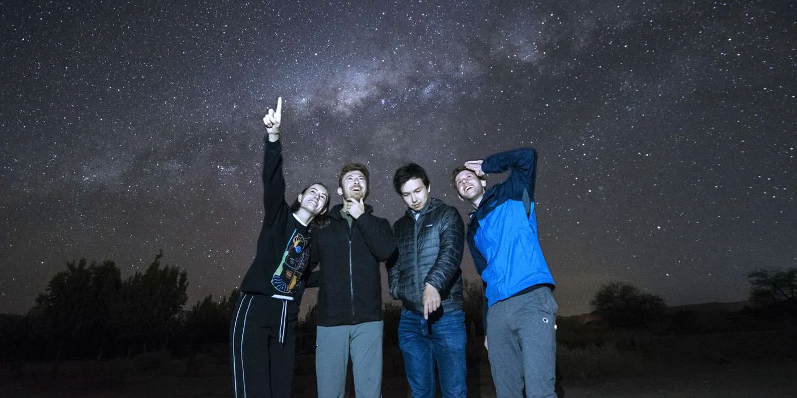
Around San Pedro, the practical way to see the sky is a visitor telescope session. Compare the formats on our stargazing tours page.
People and history
- Chinchorro (about 7000 to 1500 BCE): coastal fisher-hunter-gatherers around Arica and Camarones. The earliest known artificial mummy, a child from the Camarones Valley, dates to about 5050 BCE. Verónica Silva of Chile’s National Museum of Natural History calls these “the oldest artificially mummified bodies in the world… 2,000 years before the first mummifications even began in Egypt.” The Chinchorro mummified everyone, not only elites. Their settlements and mummification sites became a UNESCO World Heritage Site in 2021, and the San Miguel de Azapa Archaeological Museum near Arica holds the largest collection.
- Lickanantay (Atacameño) people: the Indigenous people of the San Pedro and Salar de Atacama oases, with roots going back thousands of years in villages such as San Pedro, Toconao, Peine and Socaire. Their language, Kunza, is classified as extinct, with the last speakers recorded around 1953, but a revival movement is active. Several sites near San Pedro, among them Laguna Chaxa and Valle de la Luna, are run or co-managed by Indigenous communities, so part of your entrance fee goes to them.
- Inca period: the Inca road network (Qhapaq Ñan, a UNESCO site since 2014) passed through the region. Pukará de Quitor, a 12th-century fortress 3 km from San Pedro, was taken by the Inca and later by the Spanish in 1540.
- The nitrate era and the War of the Pacific (1879–1883): Chile took the nitrate-rich provinces from Peru and Bolivia, leaving Bolivia landlocked. Nitrate funded Chile until synthetic fertilisers collapsed the trade. The ghost towns of Humberstone and Santa Laura, 47 km east of Iquique, have been a UNESCO World Heritage Site since 2005 and were on the In Danger list from 2005 to 2019.
The uncomfortable side: the clothing dumps
Near Alto Hospicio, above Iquique, discarded second-hand and unsold clothing has piled up in the desert. AFP reported in 2021 that some 59,000 tonnes of clothing arrive at the port of Iquique each year and that at least 39,000 tonnes that cannot be sold end up in dumps in the desert; other estimates vary. The goods enter through the Iquique free-trade zone, and much of it is dumped or burned illegally. The dumps have since been the subject of court action in Chile. This is not a tourist attraction and we do not suggest visiting it. If the issue interests you, look up local groups such as Desierto Vestido.
The Atacama in numbers
| Number |
What it means |
Source |
| 1,000–1,100 km |
North–south length |
Britannica |
| About 105,000 km² |
Area of the core desert (about 128,000 km² with the Andean slopes) |
Scientific Reports 2018; reference works |
| Under 2 mm a year |
Rainfall in the hyperarid core |
Scientific Reports 2019 |
| About 15 mm a year |
Normal rainfall across the desert |
CONAF |
| 14% |
Constant soil humidity at 1 m at María Elena South, matching Mars readings |
Azua-Bustos et al. 2015 |
| At least 40 million years |
Minimum age of hyperaridity |
Nature Communications 2026 |
| 1997 |
Year NASA began testing rovers here |
NASA |
| Nearly 40% → over 60% |
Chile’s share of world astronomical observation capacity, today and by 2030 |
Dark Skies Council, 2025 |
| 39 m |
ELT main mirror diameter |
ESO |
| About 3,000 km² |
Salar de Atacama area |
USGS |
| About 5050 BCE |
Earliest deliberate Chinchorro mummification |
UNESCO and reference works |
| 2005 / 2021 |
UNESCO listing of Humberstone and Santa Laura / the Chinchorro sites |
UNESCO |
| About 2,400 m |
Altitude of San Pedro de Atacama |
Local sources |
| About 4,320 m |
Altitude of the El Tatio geyser field |
Reference works |
| 6,893 m |
Ojos del Salado, the world’s highest active volcano, on the Atacama’s southeastern edge |
Reference works |
Myths and facts
| Myth you’ll read online |
The fact |
| “It never rains in the Atacama.” |
It rains rarely, and sometimes heavily. Floods hit in 2015 and 2017, and winter 2026 was unusually wet. The core averages under 2 mm a year. |
| “Calama went 400 years without rain until 1971.” |
Unverified. Treat it as legend, not a record. |
| “It never snows.” |
It does. Major snowfalls hit in 2011, June 2025 and August 2026, closing ALMA and the roads to El Tatio. |
| “The Atacama is the driest place on Earth.” |
It is the driest non-polar desert. Parts of Antarctica’s McMurdo Dry Valleys are drier. |
| “Yungay is the driest spot.” |
It was the benchmark for over a decade, until María Elena South was shown to be drier in 2015. |
| “It’s hot.” |
It is a cool desert. San Pedro days are warm, but nights are cold and Altiplano mornings can drop to −10 °C or lower. |
| “It’s been dry for 150 million years.” |
Broad aridity may go back that far, but a 2026 study dates hyperaridity to at least 40 million years. |
| “You can float like in the Dead Sea anywhere.” |
Only in specific lagoons, mainly Laguna Piedra at the Cejar complex. Swimming is restricted at many lagoons to protect them. |
| “The mummies are Egyptian-style royalty.” |
Chinchorro mummies are about 2,000 years older than Egypt’s, and the Chinchorro mummified everyone regardless of status. |
| “Chile has 70% of the world’s telescopes.” |
The observatories’ own figure is nearly 40% of observation capacity today, rising past 60% by 2030. |
| “The flowering desert happens every spring.” |
Only after unusually rainy winters, every few years. 2026 was a major bloom year around Copiapó and Vallenar, far south of San Pedro. |
Where to go in the Atacama: regions and bases
Base yourself in San Pedro de Atacama for four or five nights, because that is where most of the famous sights are. Add the coast (Antofagasta and Paranal), Iquique or Arica if you have a week or more and an interest in history, astronomy or the flowering desert.
| Region or base |
Approximate distance from San Pedro |
Why go |
Days needed |
| San Pedro de Atacama |
— |
Valle de la Luna, El Tatio, the Salar de Atacama and flamingos, the Altiplanic lagoons, Laguna Cejar, Piedras Rojas, Puritama, stargazing |
3–5 |
| Calama and Chuquicamata |
About 100 km, 1.5 h |
Airport hub; the Chuquicamata mine tour if it is running |
½–1 |
| Bolivia: Uyuni salt flat |
A 3-day 4x4 crossing |
Salar de Uyuni, Laguna Colorada, the Sol de Mañana geysers |
3–4 |
| Antofagasta coast |
About 310 km, 4 h |
La Portada natural arch, Mano del Desierto, Paranal observatory on Saturdays |
2 |
| Iquique and Humberstone |
About 490 km, 6 h |
The UNESCO nitrate ghost towns, paragliding, the Pica oasis, beaches |
2–3 |
| Arica and Lauca National Park |
About 800 km, 10 h, or fly via Santiago |
Chinchorro mummies, Lago Chungará at 4,500 m, Parinacota volcano, vicuñas |
3–4 |
| Copiapó and the southern Atacama |
About 870 km, 10–11 h |
The desierto florido in bloom years, Pan de Azúcar National Park, Nevado Tres Cruces, Ojos del Salado |
3–4 |
| Elqui Valley (edge of the desert) |
About 1,200 km; fly |
Pisco, dark-sky observatories, small valley villages |
2–3 |
Distances are approximate road figures; check your route before you drive.
Our pick for first-timers: fly Santiago to Calama, spend four nights in San Pedro, then either cross to Bolivia on an Uyuni tour or fly home. Add Antofagasta and Paranal only if you can be there on a Saturday with a confirmed ESO booking.
Plan your trip: the essentials in one place
How to get there
Fly to Calama (CJC) from Santiago, which takes about 2 hours, then take a shared or private transfer of about 1.5 hours to San Pedro. The Calama Airport transfer to or from San Pedro de Atacama (4.6/5 from 858 reviews) starts at about US$30. Overnight buses from Santiago or Antofagasta are the budget option. See Calama airport to San Pedro and getting there.
When to go
Any month works. September to November and March to May give the best balance of mild days, fewer crowds and steady stargazing. December to February is peak season, and January and February can bring Altiplanic storms that close the high routes. June to August is cold and occasionally snowy, with very clear skies. See the best time to visit.
How long to stay
Four nights at the minimum, five ideally. That gives you an easy first day at San Pedro’s altitude before the 4,000 m trips. See how many days to spend, then pick the three-day or four-day plan.
Where to stay
Stay in the centre of San Pedro or within walking distance of Calle Caracoles. The options run from dorms and simple adobe guesthouses to all-inclusive lodges with guided excursions. Book early for December to February and Chilean holidays. See where to stay in San Pedro de Atacama.
Tours or self-drive
Book tours for El Tatio (a predawn start at 4,300 m on a rough road), the Altiplanic lagoons and stargazing. A rental car gives you freedom for Valle de la Luna, Laguna Cejar, Chaxa and Puritama. Never drive to altitude on day one, carry cash for entrance fees, fill up in San Pedro (Socaire has no fuel or ATM) and check closures after snow. Compare the day trips on our San Pedro tours page, or see San Pedro without a car.
What an Atacama trip costs in 2026
San Pedro is one of the more expensive places in Chile, because almost everything is trucked in. The figures below are tour prices from the listings on this site and the official entry fees.
Many entry fees are paid in cash, and the ATMs in town can run dry, so withdraw pesos in Calama. Exchange rates move, so convert at the current rate before you budget.
One way to save: foreign tourists are exempt from Chile’s 19% VAT (IVA) on accommodation at hotels registered with the tax authority (SII) when they pay in foreign currency or with a foreign card and show their passport and PDI tourist card. Ask at check-in whether your rate includes IVA.
Practical essentials
| Topic |
What you need to know |
| Entry and visas |
Visa-free for up to 90 days on US, UK, EU, Canadian and Australian passports, and many others. Keep the PDI tourist card you get on arrival for the hotel IVA exemption. Complete the SAG customs declaration online before arrival and declare all food, plants and animal products; Chile is strict about this. |
| Money |
Chilean peso (CLP). Cards are widely accepted in San Pedro hotels, restaurants and agencies, but bring cash for some entrance fees, small shops and tips. |
| Safety |
San Pedro is generally safe and relaxed. The main risks are altitude, sun, cold and road accidents. Australia’s Smartraveller advises a high degree of caution in Chile overall and the US State Department rates it Level 2, mainly because of crime and unrest in the big cities. Watch your bags in Calama and Santiago, and carry a light when you walk at night, because stray dogs are common. |
| Altitude |
San Pedro is at about 2,400 m and day trips reach 4,200–4,800 m. Do the low trips first (Valle de la Luna, Cejar), drink plenty of water and skip alcohol on night one. See the altitude guide. |
| Sun and dryness |
UV is extreme. Bring SPF 50, a brimmed hat, sunglasses, lip balm and moisturiser, and drink often in the dry air. |
| Water |
Tap water is treated but very hard and mineral-heavy, and most visitors and locals do not drink it. Use your hotel’s refill station and a reusable bottle. |
| Connectivity |
Mobile data works in town and eSIMs are widely sold, but coverage disappears on most excursions. Socaire is the last signal on the lagoons route, so download offline maps. |
| Electricity |
220 V, 50 Hz; Type C and Type L plugs. Bring an adapter. |
| Time zone |
Mainland Chile time: UTC−4, and UTC−3 in summer. |
| Tipping |
Restaurants usually add a suggested 10% propina, and it is polite to pay it. If you are happy with a day tour, tip the guide. |
| Language |
Spanish. Useful phrases: Hola / Gracias / ¿Cuánto cuesta? / ¿Aceptan tarjeta? / La cuenta, por favor / Estoy mareado (I feel dizzy or altitude-sick). |
| Responsible travel |
Stay on marked paths, because desert crusts take decades to recover. Do not swim where it is prohibited, skip sunscreen before lagoon floats where asked, never feed foxes and pay the community site fees. Do not drive off-road: tyre tracks stay for decades. |
Packing list
- Layers: a thermal base layer, fleece and down jacket for the 04:30 El Tatio start, when it can be −10 °C, and a T-shirt for the warm afternoon.
- Sun kit: SPF 50, a wide-brimmed hat, polarised sunglasses and SPF lip balm.
- Water: a 1–2 litre reusable bottle or hydration pack.
- Feet: closed trail shoes, plus sandals or water shoes for the lagoons and Puritama.
- Extras: a swimsuit and quick-dry towel, a head torch with a red-light mode for stargazing, a plug adapter, a buff for dust, moisturiser, saline nasal spray and any altitude medication your doctor recommends.
The full list is on our what to pack page.
Start here: San Pedro guides by question
Is the Atacama worth it?
Yes, for most travellers who come for landscape and sky. In four or five days, from one walkable base, you get salt flats, geysers, volcanoes, lagoons and dunes, plus night skies that few places match. The trade-offs are high prices by Chilean standards, early starts, altitude and some crowding at the top sites. Go in the shoulder season, book stargazing for a dark night (moon phase permitting), save El Tatio until you have adjusted to the altitude and consider the Uyuni crossing if you want the Bolivian side too.
Chile side or Bolivia side: the Chilean side around San Pedro has better hotels, food, roads and stargazing, and suits short trips. The Bolivian side around Uyuni and the Eduardo Avaroa reserve is wilder and cheaper, but it means multi-day 4x4 tours with basic lodging at close to 5,000 m. Many travellers do both: a few nights in San Pedro, then the crossing on the 4-day Uyuni salt flats tour (4.6/5 from 88 reviews) or a one-way trip.